When it comes to flying a drone, there’s a few things you need to be acutely aware of. First priority is your legal requirements, but second is planning. The idea of heading somewhere to randomly fly can be fine, but if you want to really capture something, a little planning can go a long way.
CASA legal requirements
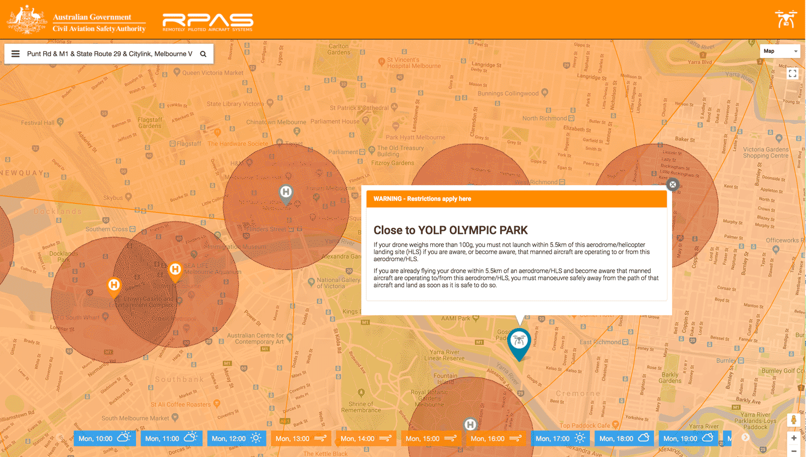
When it comes to legal requirements, there are some places where a flight could mean jail-time. And sure, that’s ‘if you get caught’. But consider this. Your drone has GPS. Your phone has GPS. Your controller has GPS. And they are all connected to servers in the cloud and stored. Basically, you and your drone location is being recorded and IF something were to happen, you need to know you will be held accountable. In Australia, CASA (Civil Aviation Safety Authority) have released an app called “Can I fly there?“, which is available on Android, iOS and a website. Check it out, download it – it’s something that explains the basics and equally, if you have any questions, ping the @CASABriefing social media team like I did, and they replied.
Hi Steven, thanks for your question.
You just have to listen and visually look out for any aircraft. Safe flying!
Kind regards, CASA Social Media team— CASA (@CASABriefing) June 8, 2018
For quite some time, I’ve assumed that flying in or near the city was a no-no. But on opening the app, I realised that while restrictions apply, you just need to understand them.
Note: Given I’m not a commercial drone operator, I’m unable to sell any drone services. And that goes for anyone with a drone who’s not commercially licensed too. Point of this post is to help share what I’ve learnt along these lines.
Finding a drone take-off location
When it comes to taking a photograph – drone, tripod, or even a snap – composition and light are everything. With this in mind, I wanted a city-scape sunset shot from a unique vantage point. I wanted to line up the sunset, city and some key icons of Melbourne. MCG, AAMI Park, Eureka Tower, The Yarra River. And this is where I used an app SunPositionMap on my Android. Also available is the super cool SunCalc.net website. Both give you the ability to see the position of the sun – including sunrise and sunset – from any position in the world. For example, I found a perfect space. It featured everything I wanted.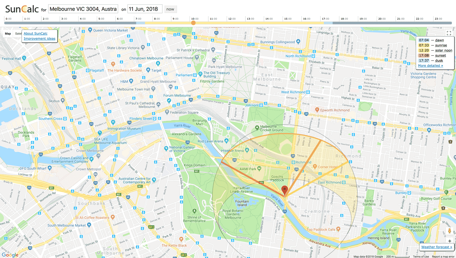
Getting this exact location, though, required a bit of back and forward with the CASA “Can I Fly There?” app. As per their website, you can see this is an okay space to fly, but with considerations.
The end result?
From there, it looked like I found the right place to get my shot. So, here it is as posted on Facebook, as well as a landing clip at the end of the shoot.
Leave a Reply